TERRA-REF Documentation
WebsiteGitHubTutorials
revisions
revisions
  • Introduction
  • Data Sources
  • Software
  • Scientific Objectives and Experimental Design
    • Protocols
      • Controlled Environment Protocols
      • Manual Field Data Protocols
      • Phenotractor Protocols
      • Sensor Calibration
      • Template Protocol
      • UAV Protocols
    • Experimental Design
      • Experimental Design Danforth
        • Sorghum Lines Danforth
      • Experimental Design Genomics
        • Sorghum Lines Genomics Year 1
        • Sorghum Lines Genomics Year 1 (continued)
        • Sorghum Lines Genomics Year 2
      • Experimental Design MAC
  • User Manual
    • What Data is Available
    • Data Products
      • Environmental conditions
      • Fluorescence intensity imaging
      • Genomics data
      • Geospatial information
      • Hyperspectral imaging data
      • Infrared heat imaging data
      • Multispectral imaging data
      • Meteorological data
      • Phenotype data
      • Point Cloud Data
    • How to Access Data
      • Using Clowder (Sensor and Genoomics data)
      • Using Globus (Sensor and Genomics data)
      • Using BETYdb (trait data, experimental metadata)
        • Accessing BETYdb via ArcMap and other GIS software
      • Using CoGe (Genomics)
      • Using CyVerse (Genomics)
      • Using Analysis Workbench (all data)
    • Data Use Policy
    • Manuscripts and Authorship Guidelines
    • Release / reprocessing schedule
  • Technical Documentation
    • Data Standards
      • Existing Data Standards
      • Agronomic and Phenotype Data Standards
      • Genomic Data Standards
      • Sensor Data Standards
      • Data Standards Committee
    • Directory Structure
    • Data Storage
    • Data Transfer
    • Data Processing Pipeline
      • Geospatial Time Series Structure
    • Data Backup
    • Data Collection
    • Data Product Creation
      • Genomic Data
      • Hyperspectral Data
    • Quality Assurance and Quality Control
    • Systems Configuration
  • Developer Manual
    • Submitting data to Clowder
    • Submitting data to BETYdb
    • Submitting Data to CoGe
    • Developing Clowder Extractors
  • Tutorials
  • Appendix
    • Code of Conduct
    • Collaboration Tools
    • Glossary
Powered by GitBook
On this page
  • Maricopa Agricultural Center, Arizona
  • Automated controlled-environment phenotyping, Missouri
  • Kansas State University
  • HudsonAlpha - Genomics
Export as PDF
  1. Technical Documentation

Data Collection

PreviousData BackupNextData Product Creation

Last updated 7 years ago

Maricopa Agricultural Center, Arizona

  • The Lemnatec Scanalyzer Field Gantry System

    • Sensor missions

    • Scientific Motivation

    • What sensors, how often etc.

  • Tractor

  • UAV

  • Manually Collected Field Data

Automated controlled-environment phenotyping, Missouri

The Scanalyzer 3D platform consists of multiple digital imaging chambers connected to the Conviron growth house by a conveyor belt system, resulting in a continuous imaging loop. Plants are imaged from the top and/or multiple sides, followed by digital construction of images for analysis.

  • RGB imaging allows visualization and quantification of plant color and structural morphology, such as leaf area, stem diameter and plant height.

  • NIR imaging enables visualization of water distribution in plants in the near infrared spectrum of 900–1700 nm.

  • Fluorescent imaging uses red light excitation to visualize chlorophyll fluorescence between 680 – 900 nm. The system is equipped with a dark adaptation tunnel preceding the fluorescent imaging chamber, allowing the analysis of photosystem II efficiency.

Capturing images

The LemnaTec software suite is used to program and control the Scanalyzer platform, analyze the digital images and mine resulting data. Data and images are saved and stored on a secure server for further review or reanalysis.

Kansas State University

HudsonAlpha - Genomics

This video overview will help explain the capture system:
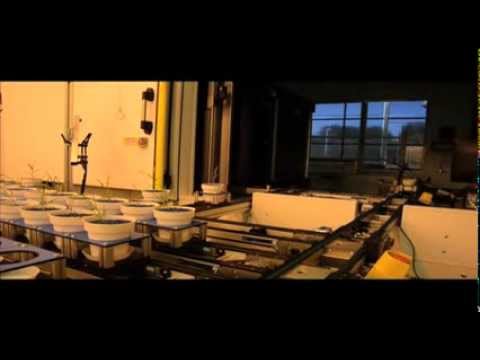
You can read more about the Danforth Plant Sciences Center Bellwether Foundation Phenotyping Facility on the .

https://docs.google.com/document/d/1iP8b97kmOyPmETQI_aWbgV_1V6QiKYLblq1jIqXLJ84/edit#heading=h.3w6iuawxkjl6
https://github.com/terraref/reference-data/issues/45
DDPSC website
LemnaTec Video Screnshot